Posted on Leave a comment

La Coulobre – Legend of a Winged Creature in European Folklore

La Coulobre - Legend of a Winged Creature in European Folklore

La Coulobre, often translated as “dragon” or “serpent,” is central to the legend associated with the village of Fontaine-de-Vaucluse, southern France, with a cluzeau (a type of well or spring) called “the hole of La Coulobre”, still visible along the banks of the Dordogne river.

The village in which the spring is located was called “Vallis Clausa” (“closed valley”) in Latin, because of its topographical position. This in time became “Vaucluse”, from which the spring takes its name. In the Provençal dialect is called Fònt de Vauclusa, “the spring of the closed valley.”

According to local folklore, La Coulobre was a fearsome dragon that terrorized the region. This malevolent creature, described in various accounts as having a serpentine body and a menacing demeanor, was said to be both a physical and symbolic representation of chaos and destruction.

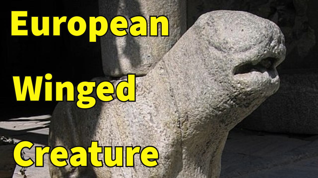
It was a winged creature, often depicted as a giant salamander, with a fetid breath. It was feared for its ability to terrorize the countryside, devouring young children and spreading disease.

She coupled with dragons that then abandoned her, forcing her to raise the small black salamanders to which she gave birth, on her own . She was desperate for a new husband and a father for her children, but her ugliness repulsed all suitors.

The Dragon’s Reign of Terror

The legend describes La Coulobre as a creature of immense power and malevolence. It was said to reside in the dark depths of the spring’s subterranean river system, emerging only to wreak havoc on the nearby inhabitants.

The dragon’s presence was marked by mysterious and disastrous events—cattle would disappear, crops would not grow, and the land would suffer from unnatural droughts. The Fontaine de Vaucluse, with its powerful flow and enigmatic depths, was believed to be La Coulobre’s lair.

The people of Vaucluse lived in constant fear of her. The dragon’s wrath was thought to be linked to the mysterious and unpredictable nature of the spring itself. The locals believed that the beast’s influence extended over the spring, controlling its flow and using it as a means to assert its dominance.

The Heroic Struggle

The legend takes a dramatic turn with the arrival of a heroic figure determined to vanquish La Coulobre and bring peace to the region. This hero is often depicted as a brave knight or a noble warrior, who, armed with courage and skills, embarks on a perilous quest to confront the dragon.

The hero’s journey is fraught with challenges, as he navigates the treacherous terrain of the Fontaine de Vaucluse, and delves into the dark and labyrinthine passages of the spring.

The confrontation between the hero and La Coulobre is the climax of the legend. The battle is described in vivid and dramatic terms, with the hero eventually emerging victorious. The dragon, defeated and slain, is said to have been driven away or killed, with its body either sinking into the depths of the spring or being cast out to prevent any further menace.

With La Coulobre vanquished, the region was said to experience a period of restoration and peace. The Fontaine de Vaucluse, once associated with fear and destruction, was now seen as a symbol of renewal and hope.

The spring continued to flow, but its waters were no longer tainted by the dragon’s malevolent influence. The land flourished, crops grew, and the village thrived.

Saint Véran and La Coulobre

A parallel legend tells that Saint Véran, bishop of Cavaillon, rid the Sorgue of a horrible Drac, a devil or dragon, La Coulobre, striking it down with his staff. This event is commemorated by a sculpture on the church square, depicting Saint Véran killing the beast.

The Sorgue is a river in Southeastern France. Its source is near the town of Fontaine-de-Vaucluse. It is the biggest spring in France and the fifth biggest in the world.

Saint Veranus of Cavaillon (died c. 590) was a French Saint, with a cultus in Italy.

Gregory of Tours writes of miracles performed by Veranus, including the expulsion of a dragon. He is also remembered as a leader in charitable works and as a patron of local monasteries, not only in France but also in Italy, particularly in the city of Albenga, where he was instrumental in the conversion of the people to Christianity.

There are various theories about the name La Coulobre:

It could be derived from the Latin word coluber (snake).

The Drac is a Ligurian divinity of tumultuous waters and the Coulobre owes its name to two Celto-Ligurian roots: Kal (stone) and Briga (hill). This is the cliff overlooking the spring which still holds the Vache d’Or (Golden Cow), the site of an ancient pastoral religion celebrating the strength and form of water and stone.

In antiquity it was a place of ritual offerings.

Petrarch’s Encounter

In the 15th century, the Italian poet Petrarch (Petrarca), reportedly encountered La Coulobre while walking along the Sorgue river with his beloved Laure.

The monster’s pestilential breath allegedly killed Laure, and Petrarch never recovered from the encounter.

Historical and Geological Background

The Fontaine de Vaucluse is a karst spring, where the water emerges from a subterranean river system.

The sheer volume of water, which can vary dramatically with the seasons, contributes to the spring’s impressive flow.

The site is nestled in a picturesque valley and is surrounded by lush greenery and towering cliffs, adding to its mystique.

This natural wonder has long been a source of inspiration and intrigue, both scientifically and culturally. Its unique features and the surrounding landscape have made it a significant location for geological study and artistic representation. But it is the legend of La Coulobre that truly enriches its lore.

In a nearby region, an Occitan legend tells of a huge winged reptile with an enormous mouth, horns, ears and claws that ended up in a druid’s hiding spot. It is said that the creature was so large that it attacked people and cattle, abducting them to devour them in its cave.

It was said that La Coulobre’s colossal force was behind the creation of the dangerous passage known as the Saut de la Gratusse, where whirlpools and strong currents led many a sailor to their untimely death.

Tale of the Nymph

A different tale recounts the story of a minstrel who fell asleep on the way to the spring and saw a nymph appear. She led him to the edge of the spring, which opened to let them descend to a meadow strewn with supernatural flowers.

The nymph showed seven diamonds to the minstrel. By lifting one of them, she made a powerful jet of water gush out. “Here,” she said, “is the secret of the spring of which I am the guardian. To make it swell I remove the diamonds. With the seventh, the water reaches the fig tree, which drinks only once a year.”

Then, she woke up the minstrel and disappeared.

Cultural and Symbolic Significance

The legend of La Coulobre and the Fontaine de Vaucluse is more than just a local story – it reflects broader cultural and symbolic themes.

Dragons and serpents are common motifs in mythology across various cultures, often representing chaos, danger or evil that must be overcome by a hero.

In French folklore, La Coulobre is part of a tradition of dragon legends that emphasize the importance of courage and the role of heroic figures in restoring balance.

These stories often serve as allegories for real-life struggles, highlighting the virtues of bravery, perseverance, and moral integrity.

The Fontaine de Vaucluse, with its mysterious and powerful spring, provides a fitting backdrop for such a narrative.

Moreover, it has become a symbol of the natural beauty and mystical allure of the region. The spring’s dramatic flow and the surrounding landscape evoke a sense of wonder and reverence, enhancing the impact of the story.

The Legacy of the Legend

Today, La Coulobre continues to captivate the imagination of visitors and locals alike.

The Fontaine de Vaucluse remains a popular destination for those seeking to experience its natural beauty and to explore the rich cultural heritage associated with it.

The legend has been preserved through various forms of storytelling, including literature, art, and local traditions.

It also highlights the enduring power of folklore to shape our understanding of natural landscapes. The story of the dragon and the hero reflects the human desire to find meaning in the natural world and its intricate relationship with it.

The legend underscores the idea that natural phenomena, such as springs and rivers, are not just physical entities, but also vessels of deeper symbolic meanings, standing as a testament to this interplay between the natural and the mythological.

The legend of La Coulobre also serves as a potent symbol of the triumph of good over evil. The hero’s victory over the dragon represents the overcoming of darkness and chaos, restoring order and harmony to the land.

This narrative resonates with timeless themes found in folklore and mythology, illustrating the universal struggle between heroic valor and destructive forces.

This essay provides a comprehensive look at the Legend of La Coulobre and its significance, exploring both the mythical narrative and its cultural impact.

It is a fascinating and eerie figure, symbolizing the power of myth, and offering a glimpse into the rich tapestry of cultural and natural heritage that defines the region and European folklore.

What do you think of the legend of La Coulobre, dragons and winged creatures? Let us know in the comment section and share the post!!!


Video version here:

La Coulobre – Legend of a Winged Creature in European Folklore


Interesting sources, additional info, images, credits, attributions and other points of views here:

https://www.grandsudinsolite.fr/1013–the-legend-of-la-coulobre.html

https://en.wikipedia.org/wiki/Fontaine_de_Vaucluse_(spring)

https://en.wikipedia.org/wiki/Veranus_of_Cavaillon

https://en.wikipedia.org/wiki/Sorgue

https://en.wikipedia.org/wiki/Petrarch

PICS:

https://commons.wikimedia.org/wiki/File:La_Sorgue_le_31_mai_2008_avec_1,53%C3%A8tres_de_hauteur,_La_Fontaine_de_Vaucluse_16.JPG

https://commons.wikimedia.org/wiki/File:Brooklyn_Museum_-_Fontaine_de_Vaucluse_-_Paul_Huet.jpg

https://commons.wikimedia.org/wiki/File:SaintV%C3%A9ran502.JPG

https://commons.wikimedia.org/wiki/File:Access_Fontaine_de_Vaucluse_by_JM_Rosier.jpg

https://commons.wikimedia.org/wiki/File:V%C3%A9ran_de_Cavaillon_(cropped).jpg

https://commons.wikimedia.org/wiki/File:Cavaillon-Cath%C3%A9drale-Mignard-Pierre.jpg

http://riviereesperance.canalblog.com/archives/2010/03/08/16567640.html

https://www.bordeauxwalkingtours.fr/en/the-legend-of-bergeracs-dragon/

https://vialucispress.wordpress.com/2019/05/25/the-saint-a-dragon-and-petrarch-too-dennis-aubrey/

https://pixabay.com/illustrations/book-adventure-snake-imagination-8794150

https://pixabay.com/illustrations/ai-generated-snake-reptile-head-7850729

https://pixabay.com/illustrations/lake-woman-goddess-of-lakes-7566031

https://pixabay.com/photos/snake-nature-reptile-wild-wildlife-2362212

https://pixabay.com/illustrations/photo-snake-reptile-species-fauna-7752725

https://pixabay.com/photos/nature-salamander-fire-salamander-3182879

https://pixabay.com/photos/spotted-salamander-water-lily-6020288

https://pixabay.com/illustrations/dragon-fire-pagan-epic-fantasy-8780168

https://pixabay.com/illustrations/dragon-mythology-english-myths-8800263

https://pixabay.com/illustrations/dragon-lake-fantasy-nature-beast-8520110

https://pixabay.com/illustrations/ai-generated-dragon-lizard-reptile-7852855

https://en.wikipedia.org/wiki/Petrarch#/media/File:Altichiero,_ritratto_di_Francesco_Petrarca.jpg

https://en.wikipedia.org/wiki/Petrarch#/media/File:Francesco_Petrarca01.jpg

https://pixabay.com/illustrations/medieval-castle-knight-st-george-8813015

https://pixabay.com/illustrations/black-dragon-dragon-fantasy-art-8808267
Posted on Leave a comment

Lost Lands and Phantom Islands: Exploring the Mysteries of Earth’s Vanishing Geographies

Lost Lands and Phantom Islands - Earth's Vanishing Geographies

The appeal of lost lands and phantom islands has captivated human imagination for centuries. These geographical enigmas, often mentioned in myths, legends, and early navigational charts, evoke a sense of mystery and adventure. They represent places that once appeared on maps or in tales, but have since eluded discovery or been debunked as fictional. This research delves into the fascinating realms of lost lands and phantom islands, exploring their origins, cultural significance, and the explanations behind their existence.

Origins and Historical Accounts

Lost lands and phantom islands have their origins in ancient cartography and folklore, where accounts of distant and mysterious lands fueled the imaginations of explorers and scholars alike. One of the most famous examples is Atlantis, the mythical island first mentioned by Plato in his dialogues. Plato described Atlantis as an advanced civilization that sank into the sea in a single day and night, sparking countless theories and expeditions in search of its remains.

In medieval times, maps depicted fantastical islands like Thule, believed to be the northernmost land reachable by ancient voyagers. Thule and similar islands represented the edge of the known world, beyond which mystery and the great unknown where located. These tales often intertwined with religious beliefs and cosmological ideas, shaping the worldview of societies.

Exploration and Encounters

During the Age of Exploration, European sailors encountered numerous phantom islands that appeared on maps but vanished upon closer inspection. These islands were sometimes the result of navigational errors, optical illusions caused by atmospheric conditions, or the misinterpretation of natural features such as icebergs or volcanic eruptions.

For instance, Buss Island, reported by several explorers in the Arctic, turned out to be a mirage caused by unusual atmospheric refraction.

Explorers like Cristoforo Colombo famously searched for mythical islands such as Antillia, believed to lie west of Portugal and Spain. The quest for these elusive lands drove exploration and pushed the boundaries of geographical knowledge, contributing to both scientific discovery and cultural exchange.

Cultural Significance and Mythology

Beyond their geographical implications, lost lands and phantom islands hold profound cultural significance. They often feature in myths and legends as paradises, utopias, or realms inhabited by supernatural beings. The tale of Avalon, the legendary island associated with King Arthur and the Lady of the Lake, embodies themes of immortality and otherworldly beauty. These narratives resonate across cultures, reflecting human desires for discovery, escape, and transcendence.

In folklore, phantom islands sometimes serve as cautionary tales, warning sailors of treacherous waters or marking the boundaries between the known and the unknown. They blur the lines between reality and fantasy, offering glimpses into the collective psyche of civilizations throughout history.

Scientific Explanations and Modern Understanding

Modern science claims to have unraveled many mysteries surrounding lost lands and phantom islands. Satellite imagery, sonar mapping, and advanced geo-spatial technologies have allowed researchers to confirm the existence or non-existence of these elusive features. For example, the island of Bermeja, once thought to lie off the coast of Mexico, was officially disproven in the 20th century through systematic surveys.

Moreover, geological processes such as tectonic activity, sea level changes, and erosion, provide some explanations for the disappearance of landmasses over time. Islands may submerge due to volcanic activity, coastal erosion, or shifts in the Earth’s crust, somewhat demystifying once-mythical places and revealing the dynamic nature of our planet’s geography.

Contemporary Examples and New Discoveries

Despite scientific advancements, tales of lost lands and phantom islands persist into the contemporary era.

Furthermore, ongoing exploration of the Arctic and Antarctic regions continues to unveil new geological features and underwater landforms previously unknown to science.

The following list of 20 lost lands and 20 phantom islands highlights the evolving nature of geographical knowledge and the interconnectedness of cultural narratives with scientific inquiry.

Lost Lands (Geography and Mythology):

  1. Atlantis: The most famous lost land, described by Plato as a highly advanced civilization that sank into the sea.
  2. Lemuria, also called Mu: A hypothetical lost continent in the Indian Ocean called Kumari Kandam, proposed in the 19th century to explain geological and biological similarities between India and Madagascar. Legendary lost continent, proposed by Augustus Le Plongeon as the homeland of the Maya civilization, now largely considered a pseudoscientific concept.
  3. Hy-Brasil: A phantom island off the coast of Ireland in Celtic mythology, said to appear every seven years and be shrouded in mist. Some researchers consider it to be a vanished land connected to present-day Brasil.
  4. Thule: In ancient Greek and Roman literature, Thule was a distant place located beyond the borders of the known world, often associated with Scandinavia or Iceland.
  5. Avalon: A legendary island in Arthurian legend, associated with King Arthur and said to be the place where the sword Excalibur was forged and where Arthur was taken after his death.
  6. Lyonesse: A mythical land said to have existed off the coast of Cornwall, England, now submerged beneath the sea.
  7. Ys: A legendary city in Breton folklore, said to have been submerged beneath the sea due to the pride and sins of its inhabitants.
  8. Greater Adria: It is named after Adria, a geologic region found in Italy, where evidence of the microcontinental fragment was first observed. Greater Adria’s size can be compared to that of modern day Greenland.The only part remaining relatively intact is a strip running from Turin and Istria to the Heel of Italy, under the Adriatic Sea. Most of the remains are 1,000 kms (620 mi) under Europe, deep in the earth.
  9. Zealandia, also known as Te Riu-a-Māui for the Maori, or Tasmantis, is an almost entirely submerged mass of continental crust in Oceania. Satellite imagery shows it to be almost the size of Australia. A 2021 study suggests Zealandia is over a billion years old, about twice as old as geologists previously thought.
  10. Neolithic Malta:When Malta was still connected by land to Sicily, circa 12,000 years ago, the site of Marsaxlokk towered at least 150 metres above sea-level.
  11. Balkanatolia. It was an island continent or a series of islands, separate from Asia and also from Western Europe. The area now comprises approximately the modern Balkans and Anatolia.
  12. Beringia: Today is defined as the land and maritime area around the Bering Strait. At various times, it formed a land bridge referred to as the Bering land bridge, that was up to 1,000 kms (620 mi) wide at its greatest extent and which covered an area as large as British Columbia and Alberta combined.
  13. Doggerland. It was an area of land in Northern Europe, now submerged beneath the North Sea, that connected Britain to continental Europe. Geological surveys have suggested that it stretched from what is now the east coast of Great Britain to what is now the Netherlands, the western coast of Germany and the Danish peninsula of Jutland.
  14. Dvaraka, an ancient submerged city in modern-era Gujarat, India. Modern Dwarka. It’s known as a Hindu pilgrimage site.
  15. Graham Island/Isola Ferdinandea is a submarine volcano in the Mediterranean Sea near Sicily that has, on more than one occasion, risen above the surface via volcanic action and soon thereafter been washed away. Since 300 BC this cycle of events has occurred four times.
  16. Kerguelen Plateau: One of the largest igneous provinces in the world, it covers an area three times the size of California. It rises 2,000m (6,600 ft) above the surrounding oceanic basins. Most of the plateau is less than 3,000 m (9,800 ft) below sea level. It’s located in the Southern Indian Ocean.
  17. Maui Nui: Located in the US state of Hawaii. Built from seven shield volcanoes. It broke up as rising sea levels flooded the connections between the volcanoes, creating the islands of the modern-era state.
  18. Sundaland is a region of Southeast Asia corresponding to a larger landmass that was exposed millions of years ago during periods when sea levels were lower. It includes Bali, Borneo, Java, Sumatra in Indonesia, and their surrounding small islands, as well as the Malay Peninsula on the Asian mainland.
  19. Viking-Bergen Banks are underwater hills in the North Sea, east of the Shetland Islands and west of Norway. When sea levels were lower during the Last Glacial Period, the hills formed an island that may have been occupied by humans.
  20. Buyan, an island with the ability to appear and disappear in Slavic mythology.

Phantom Islands:

  1. Sandy Island: A phantom island that appeared on maps in the Coral Sea, supposedly located between New Caledonia and Australia. It was listed as non-existent in 2012.
  2. Frisland: A phantom island shown on maps in the North Atlantic Ocean during the Age of Discovery, now believed to have been a cartographic error.
  3. Buss Island: Reported by several explorers in the Arctic, Buss Island turned out to be a mirage caused by unusual atmospheric refraction.
  4. St. Brendan’s Island: A phantom island in the Atlantic Ocean, appearing on maps from the 15th to 18th centuries, named after the legendary Irish saint.
  5. Antillia: A phantom island west of Portugal and Spain, appearing on maps during the Age of Discovery, possibly originating from tales of Atlantis.
  6. Emerald Island: Reported to lie between Australia and Antarctica and south of Macquarie Island. Said to be a lush, green paradise.
  7. Crocker Land: A phantom island supposedly sighted during an Arctic expedition, later found not to exist. A hoax invented by explorer Robert Peary to gain more financial aid from George Crocker, one of his financial backers.
  8. Aurora Islands: Phantom islands reported in the South Atlantic, believed to be visible only under specific weather conditions.
  9. St. Matthew Island: A phantom island once thought to lie roughly one thousand kilometers northeast of Ascension Island in the Atlantic Ocean. It appeared on navigational charts as late as the twentieth century.
  10. Isle of Demons: A phantom island reported by sailors in the North Atlantic in Canada. It was believed that the island was populated by demons and wild beasts which would torment and attack any ships that passed, or anyone that was foolish enough to wander onto the island.
  11. Island of Mayda: A non-existent island in the North Atlantic that has been shown on several published maps at various points in history. It was most often represented as being crescent-shaped and its position has varied widely over time. Early maps drew the island west of Brittany and southwest of Ireland.
  12. Porcupine Bank: A phantom island reported off the west coast of Ireland, believed to have been a misidentification of a shallow bank.
  13. Anaa-ti. Located in French Polynesia in the Southern Pacific Ocean. Believed to be a mistaken sighting of a nearby island.
  14. Antonio de Ulloa Island.Discovered by the Spanish captain Antonio de Ulloa in the South Pacific Ocean. Noted as doubtful in 1875.
  15. Arthur Island. Phantom Island in the South Pacific Ocean. Noted to be needing confirmation of existence and position in 1851; not seen on modern maps.
  16. Bermeja.Discovered in the early 16th century by Spain, but mysteriously vanished sometime during the 17th century. A phantom island off the coast of the Yucatán Peninsula, Mexico, which appeared on maps until it was disproven in the 20th century. While no dominant theory holds, it is possible that the island submerged due to tectonic movements, nearby Scorpion Reef.
  17. Bonetta Rocks.Location given between Cape Verde and Mauritania. Could not be found in 1838.
  18. Cassiterides. Ancient source of Phoenician tin. Exact location unknown but thought to have possibly referred to now silt-connected islands within the marshes of Briere.
  19. Davis Land. Supposedly sighted by the pirate Edward Davis in the Pacific along the same latitude as the Spanish-controlled gold mines of Copiago. At the time, it was believed that gold could be found elsewhere along the latitude, so several navigators were instructed to search for it. Never found, it was also believed by William Dampier to be the coast of Terra Australis Incognita.
  20. Cloate’s Island. West of Australia. Removed from charts by 1856 or earlier.

These lost lands, vanished cities and phantom islands have fascinated explorers, historians, and cartographers throughout history, blending myth, folklore, and geographical exploration into a rich tapestry of cultural narratives and mysteries.

They represent more than mere geographical curiosities—they embody the human spirit of exploration, imagination, and discovery.

From ancient myths to modern scientific scrutiny, these enigmatic features have shaped historical narratives and cultural identities across civilizations. Their legacy endures in literature, art, and the collective consciousness.

What do you think about lost lands and phantom islands? Let us know in the comment section below and share the post!!!


Video version here:

Lost Lands and Phantom Islands


Interesting sources, additional info, images, credits, attributions and other points of views here:

https://en.wikipedia.org/wiki/List_of_lost_lands

https://en.wikipedia.org/wiki/Greater_Adria

https://en.wikipedia.org/wiki/Zealandia

https://en.wikipedia.org/wiki/Balkanatolia

https://en.wikipedia.org/wiki/Beringia

https://en.wikipedia.org/wiki/Doggerland

https://en.wikipedia.org/wiki/Dv%C4%81rak%C4%81 Dwarka

https://en.wikipedia.org/wiki/Graham_Island_(Mediterranean_Sea)

https://en.wikipedia.org/wiki/Kerguelen_Plateau

https://en.wikipedia.org/wiki/Maui_Nui

https://en.wikipedia.org/wiki/Sundaland

https://en.wikipedia.org/wiki/Viking-Bergen_Banks

https://en.wikipedia.org/wiki/Atlantis

https://en.wikipedia.org/wiki/Avalon

https://en.wikipedia.org/wiki/Buyan

https://en.wikipedia.org/wiki/Kumari_Kandam (Lemuria)

https://en.wikipedia.org/wiki/Lemuria

https://en.wikipedia.org/wiki/Mu_(mythical_lost_continent)

https://en.wikipedia.org/wiki/Ys

https://en.wikipedia.org/wiki/Phantom_island

Further reading

Credits/Attributions

https://commons.wikimedia.org/wiki/File:Kumari_Kandam_map.png

https://commons.wikimedia.org/wiki/File:Ortelius_1572_Ireland_Map_2.jpg

https://commons.wikimedia.org/wiki/File:Thule_carta_marina_Olaus_Magnus.jpg

https://commons.wikimedia.org/wiki/File:StampThule1935Michel3.jpg

https://commons.wikimedia.org/wiki/File:Burne-Jones_Last_Sleep_of_Arthur_in_Avalon_v2.jpg

https://commons.wikimedia.org/wiki/File:The_Death_of_King_Arthur.jpg

https://commons.wikimedia.org/wiki/File:Bronze_Age_Scilly_Coastline_in_3,000_BC.png

https://commons.wikimedia.org/wiki/File:Evariste-Vital_Luminais_-_Fuite_de_Gradlon.jpg

https://commons.wikimedia.org/wiki/File:383_Kerlaz.jpg

https://en.wikipedia.org/wiki/File:Auguste_Fran%C3%A7ois-Marie_Gorguet_-_poster_for_the_premi%C3%A8re_performance_of_%C3%89douard_Lalo%27s_Le_roi_d%27Ys_(1888).jpg

https://commons.wikimedia.org/wiki/File:Zealandia_topography.jpg

https://commons.wikimedia.org/wiki/File:Malta_relief_location_map.png

https://www.cnrs.fr/en/press/balkanatolia-forgotten-continent-sheds-light-evolution-mammals

https://commons.wikimedia.org/wiki/File:Beringia_land_bridge-noaagov.gif

https://commons.wikimedia.org/wiki/File:Beringia_-_late_wisconsin_glaciation.png

https://commons.wikimedia.org/wiki/File:Doggerland.svg

https://commons.wikimedia.org/wiki/File:Doggerbank.jpg

https://commons.wikimedia.org/wiki/File:Dwarka1.jpg

https://commons.wikimedia.org/wiki/File:Dwarkadhish_Temple_20.jpg

https://commons.wikimedia.org/wiki/File:Map_of_Graham_Island.jpg

https://commons.wikimedia.org/wiki/File:HMS_Melville_and_Graham_Island.jpg

https://commons.wikimedia.org/wiki/File:KerguelenPlateau_v1.png

https://commons.wikimedia.org/wiki/File:Bathymetry_image_of_the_Hawaiian_archipelago.png

https://commons.wikimedia.org/wiki/File:Map_of_Sunda_and_Sahul.svg

https://commons.wikimedia.org/wiki/File:North_Sea_map-en.png

https://commons.wikimedia.org/wiki/File:Ivanbilibin.jpg

https://commons.wikimedia.org/wiki/File:Sandy_Island_on_1908_chart_-_cropped.jpg

https://commons.wikimedia.org/wiki/File:Bermeja.jpg

https://commons.wikimedia.org/wiki/File:Map_by_nicolo_zeno_1558.jpg

https://commons.wikimedia.org/wiki/File:Buss_Island.jpg

https://commons.wikimedia.org/wiki/File:St_Brendan%27s_island.jpg

https://commons.wikimedia.org/wiki/File:Portolan_chart_by_Albino_de_Canepa_1489.jpg

https://commons.wikimedia.org/wiki/File:Antarctica_1912_edit.jpg

https://commons.wikimedia.org/wiki/File:Bradley_Land.jpg

https://commons.wikimedia.org/wiki/File:Lwsam_1808.jpg

https://commons.wikimedia.org/wiki/File:Theatrum_Orbis_Terrarum_-_Africae_Tabula_Nova.jpg

https://commons.wikimedia.org/wiki/File:TerreNeuve16e.jpg

https://commons.wikimedia.org/wiki/File:Mayda_Pizigani.jpg

https://commons.wikimedia.org/wiki/File:Porcupine_Bank_and_Seabight,_NE_Atlantic.png

https://commons.wikimedia.org/wiki/File:Polyn%C3%A9sie_fran%C3%A7aise_collectivity_location_map.svg

https://commons.wikimedia.org/wiki/File:Pacific_Ocean_-_en.png

https://en.wikipedia.org/wiki/File:South-pacific-map.jpg

https://commons.wikimedia.org/wiki/File:Cape_Verde_(orthographic_projection).svg

https://commons.wikimedia.org/wiki/File:Map_of_Europe_according_to_Strabo.jpg

https://commons.wikimedia.org/wiki/File:AMH-8032-KB_Map_of_the_Pacific_Ocean,_with_Australia_and_the_west_coast_of_South_America.jpg

https://commons.wikimedia.org/wiki/File:Exmouth_caperange_beach.jpg

https://pixabay.com/photos/desert-mountains-landscape-orange-4830921

https://pixabay.com/photos/sea-ocean-expanse-blue-water-1090586

https://pixabay.com/photos/desert-badlands-panorama-barren-1170055

https://pixabay.com/illustrations/desert-cave-lonely-alone-planet-7667243

https://pixabay.com/photos/plank-choice-home-or-lost-home-729441

https://pixabay.com/photos/lost-found-lost-and-found-searching-1605501

https://pixabay.com/photos/landscape-mountains-meadow-heaven-3530951

https://pixabay.com/photos/wheat-grain-field-land-agriculture-3494280

https://pixabay.com/photos/desert-arid-land-landscape-drought-5507220

https://pixabay.com/photos/desert-mountains-countryside-74781

https://pixabay.com/photos/land-scape-big-sky-custer-dakota-3485399

https://pixabay.com/photos/island-sea-costa-clouds-sunset-7756423

https://pixabay.com/photos/island-tropical-beach-palm-trees-1285147

https://pixabay.com/photos/beach-island-landscape-ocean-2179361

https://pixabay.com/photos/island-sea-ocean-horizon-sunset-1867510

https://pixabay.com/photos/ocean-mountain-sunset-island-3740996

https://pixabay.com/photos/ocean-beach-water-sand-nature-4270249

https://pixabay.com/photos/tropical-island-blue-ocean-beach-5074304

https://pixabay.com/photos/island-bora-bora-tahiti-7335510

https://pixabay.com/photos/clouds-fog-mist-island-nature-1850093